| This site was founded by the late John Skakel. Contact us HERE
Cemeteries Office Staff have asked that users NOT contact them with questions directly. Some History of The Shaw (Shawbanks) Cemetery
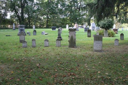
The Shawbanks (Shaw) Cemetery. |
About 1750 - 1775 a Sea Captain named Wm Shaw purchased land beside the present village of Kent Bridge. At some point a family cemetery was began on the farm which became known as Shaw Cemetery or Shawbanks Cemetery. Captain Wm Shaw was buried in that cemetery when he died, and the grave was marked with a wooden cross. Since those crosses of that period deteriorated they were replaced in the 1990's by a new granite stone with the names inscribed.
Capt Wm had a son named Captain John Shaw. He is interred inside the iron fence at the site. The grave is of course marked by a huge stone.
Blake mentions that Shawbanks was very much a family cemetery. It is still to this day a private one.
Apparently around 1978 the cemetery had gotten into very bad shape. It was let go with many weeds growing, and many stones had been tipped over and were thrown over to the edge of the river. Blake mentions that he and others came in and spent a lot of time cleaning up the cemetery. Levelling the ground and getting rid of weeds and brush. Getting the grass tamed and mowed, etc. It seems that many stones were able to be moved back as they knew the location that they had came from. However, others they did not know and were mostly in pieces too small to identify. Many of these tiny pieces can be seen along the river banks yet today. Blake gives Iris Dobson, the wife of Glynn and Mom of Hank very big credit in getting the cemetery all cleaned up once again. Kay Dobson, Hank's wife, has taken a very active part in the cemetery board for a long while.
It is thought that a Captain Ackert who was shot just before the battle of Moraviantown by the American soldiers died of his wounds and is interred in Shawbanks cemetery. However, at the moment this is still not proven as neither records nor the stone monument can be found.
Scanning seems to indicate some sort of Communal Burial Area, or "Potter's Field" along the South West side of the Cemetery just in from the edge about one plot in an open area going all across the cemetery. This seems to indicate rows of babies, etc. However, the fact this is a family cemetery would not seem to support this. Records do not explain what is going on there. So we probably never will know the answers here.
Sensing indicates four buildings on the Thamesville side of the Cemetery just outside of it's edge. One is tucked in between the cemetery and the bush right at River's edge. We know there was a school here, because your writer has three desk tops from it in my position. They were removed what is likely over a hundred years ago indicating this may be when it was torn down. Indications are of another large building, one slightly smaller, and one smaller again on the opposite side of what was likely an old trail. (The original road.) These may well be a barn, a house, and an outbuilding in that order.
Tempory Information Storage |